The Pools of Dee sit near the summit of the Lairig Ghru, the great mountain pass that cuts through the heart of the Cairngorms, at an altitude of 815 metres. They are a series of small, luminously clear lochans — some shaded green against the bare granite — that appear almost impossibly vivid in the grey vastness of the high plateau. For many walkers, they are the visual reward at the end of a long and demanding approach, the moment the remote wilderness becomes something close to magical. Understanding what the pools are, how to reach them, and what to expect will help you plan a walk that is one of the most rewarding in Scotland.
- The Pools of Dee lie at 815 metres in the Cairngorm Mountains, just south of the highest point of the Lairig Ghru pass (835 metres).
- They are one of two recognised sources of the River Dee, whose waters eventually supply Aberdeen and more than half of Aberdeenshire.
- At least one of the pools is reputed to contain wild trout despite having no obvious inflow or outflow visible at the surface — the water moves south through the stones beneath.
- The return day walk from Aviemore is approximately 22–24 km and takes most fit walkers 6–8 hours; the terrain is serious and remote.
- The Gaelic name — Lochan Dubh na Lairige — means “the black tarn of the Lairig.”
What Are the Pools of Dee?
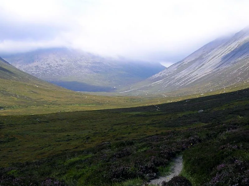
The Pools of Dee are not a single dramatic waterfall or a wide blue loch. They are something quieter and more unexpected: three or four small, clear mountain lochans tucked into the floor of the Lairig Ghru near its highest point, surrounded by the kind of rough granite scree that defines the high Cairngorms. Arriving at them after hours of walking through forest and open moorland and a final grinding boulder field gives them an earned quality that is rare in the British hills.
Location and altitude
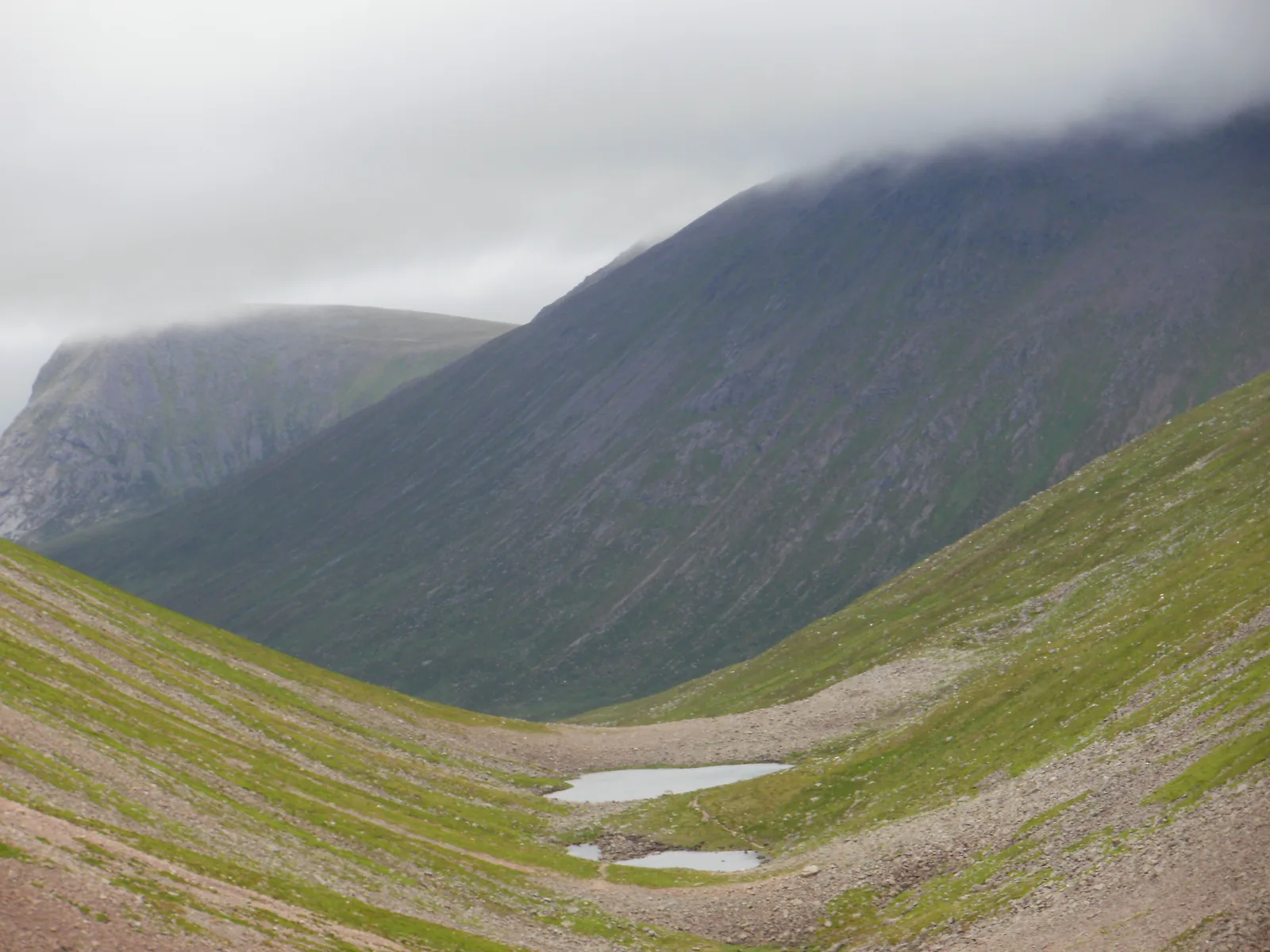
The pools sit at an altitude of 815 metres (2,674 feet), just below the Lairig Ghru’s summit point of 835 metres (2,740 feet) — making them among the highest named water features in the British Isles. The pass they inhabit cuts between the massifs of Braeriach (to the west) and Ben Macdui and Cairn Toul (to the east and south), framing the pools with some of the highest mountains in Britain. The Gazetteer for Scotland records them as lying just south of the Lairig Ghru’s highest point, where the March Burn, draining from the surrounding scree slopes, feeds the lochans with snowmelt and rainwater. The great peak of Cairn Toul (1,291 metres) is visible from the pools on a clear day, an imposing presence to the south-west.
What the pools look like
Several of the pools are vibrant green-blue, their colour catching the light against the grey-brown stones — a contrast that makes them look almost artificially vivid in photographs and surprisingly beautiful in person. The lochans have no obvious surface inflow or outflow, which gives them an enigmatic quality. In reality, the water flows southward through the stones and gravel beneath the pools rather than over them in a visible stream. This subterranean drainage means that at least one of the pools is reputed to contain wild trout, an extraordinary fact given the apparent isolation of the water at this altitude. The Gaelic name for the pools, Lochan Dubh na Lairige — “the black tarn of the Lairig” — reflects how they would appear in low light or under a grey Scottish sky, the clear water turning dark and opaque.
Connection to the River Dee
The Pools of Dee are frequently described as one of the two sources of the River Dee, one of Scotland’s great rivers. From these high lochans, water drains via the Allt na Lairig Ghru and the Allt a’ Gharbh Choireich to form the upper River Dee, which flows some 140 kilometres (87 miles) eastward through Braemar, Balmoral and Aboyne before reaching the North Sea at Aberdeen. The Dee provides drinking water to more than 300,000 people in Aberdeen City and over half of Aberdeenshire, making the pools’ connection to it an unexpectedly civic fact for such a remote location. The other recognised source of the Dee — the Wells of Dee — sits on the plateau of Braeriach at approximately 1,220 metres, considerably higher still. When you stand at the Pools of Dee, you are near the beginning of a river system on which an entire city depends.
Walking to the Pools of Dee
The Pools of Dee are not accessible by road; they sit deep in the interior of the Cairngorms National Park, and the only way to reach them is on foot. The two main approaches — from Aviemore to the north, or from Linn of Dee to the south — both require commitment, but the northern approach from Aviemore is more commonly done as a day walk specifically to reach the pools and return. This section covers that route in detail.
The route from Aviemore through Rothiemurchus
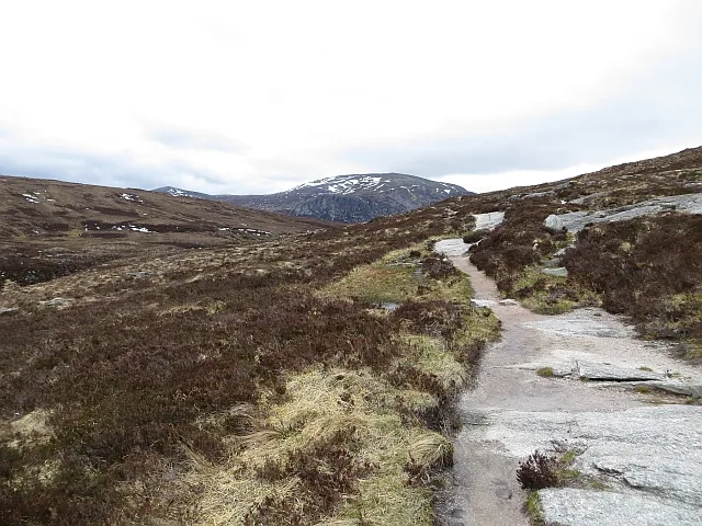
The standard northern approach begins at Coylumbridge, a small village about 3 km south-east of Aviemore town centre. Park at the roadside near the entrance to Rothiemurchus Camp and Caravan Park, then follow the lane past a derelict cottage to a small parking area. From there, pass through the gate and follow the track south through the first section of Rothiemurchus Forest, a magnificent area of ancient Caledonian pine on the lower slopes of the Cairngorms. The forest section is flat and easy walking — approximately 6–7 km — before the path emerges onto open ground. At Piccadilly junction, where several paths converge, bear right and south into the pass itself. The path climbs progressively and the landscape opens dramatically: Lurcher’s Crag and the flanks of Braeriach on the left, the rocky slopes of Ben Macdui on the right. The final approach to the Pools of Dee involves a demanding boulder field where the path is less obvious and progress slows considerably — allow extra time for this section.
Distance, time and difficulty
The round trip from Coylumbridge to the Pools of Dee and back is approximately 22–24 kilometres (14–15 miles) with around 600–700 metres of total ascent. Most fit and experienced walkers will take 6–8 hours for the full day out, including time at the pools. The walk is graded strenuous: the terrain is remote and there are no easy escape routes once you have committed to the upper pass. The boulder field below the summit is tiring and ankle-twisting. The Lairig Ghru is a serious mountain route; it sits at over 800 metres in one of Britain’s highest and most exposed mountain environments, and conditions can change from calm to hostile within an hour. It is not a casual walk, but it is accessible to fit hillwalkers without technical skills or specialised equipment in good summer conditions.
What to expect at the summit
After the boulder field, the ground levels off briefly and the Pools of Dee appear ahead and slightly below the path. They sit in a wide, stony hollow at the floor of the pass, dwarfed by the slopes around them. The largest pool is perhaps 30–40 metres across; others are smaller and sit at slightly different levels in the basin. In summer the water is startlingly clear. The Cairngorm Club Footbridge — a historic crossing erected in 1912 on the lower part of the route — is behind you by this point; ahead, the pass drops gradually south towards Corrour Bothy and the upper River Dee. Allow at least 20–30 minutes at the pools before the return journey: the elevation, the silence, and the scale of the surrounding peaks make it a rare and memorable place to pause.
Practical Guide: Getting There and Staying Safe
A walk to the Pools of Dee is achievable in a day from Aviemore, but it requires proper preparation. The Cairngorms are the most extensive high-altitude terrain in the UK and the weather is genuinely unpredictable. This is one of those Scottish walks where the gap between a good day and a dangerous one is narrow.
Getting there and parking
From Aviemore, follow the B970 road south-east towards Coylumbridge. The parking area near Rothiemurchus Camp and Caravan Park (postcode PH22 1QH as an approximate reference) is the most common starting point. Roadside parking is available but limited — arrive early on summer weekends. There is no public transport directly to this trailhead, but Aviemore itself is on the main Inverness railway line (operated by ScotRail) and has good bus connections; a taxi or lift from town to Coylumbridge takes under ten minutes. The southern approach via Linn of Dee starts from the car park at Linn of Dee (postcode AB35 5YS), roughly 10 km west of Braemar, and provides access to the Pools of Dee via the Corrour route — a longer day, typically 32 km.
What to bring and when to go
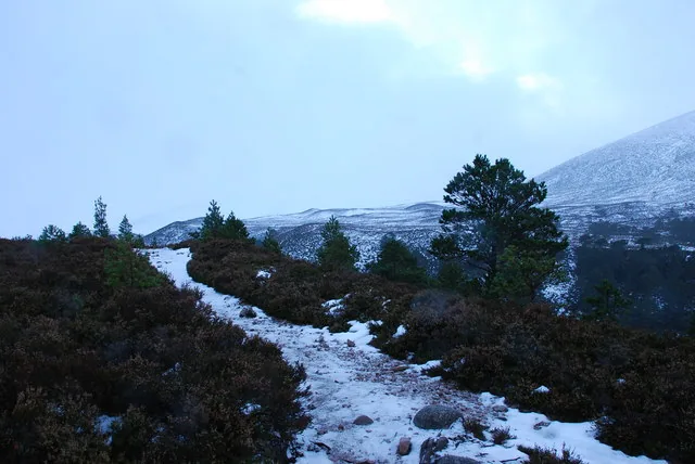
The best conditions for the walk are June through September, when snow is typically absent and daylight is long. Even in summer, temperatures at 800+ metres can drop significantly, and the weather changes rapidly. Always carry full waterproof and windproof clothing regardless of the forecast. A detailed OS map (OS Explorer 403 covers the area) and a compass, and the ability to use them, are essential — mobile signal is absent for much of the route. Bring enough food and water for a full day; there are no facilities anywhere on the walk. Register your phone with the emergency services (text 999 to register) in advance in case of an accident in an area without signal. Tell someone your planned route and expected return time. Winter travel in the Lairig Ghru requires mountaineering skills and equipment; it is not a walk for November to April without specific experience.
Extending the walk: Corrour Bothy and beyond
Beyond the Pools of Dee, the Lairig Ghru descends south for a further 8 km to Corrour Bothy, a remote mountain shelter maintained by the Mountain Bothies Association and available free to all walkers without prior booking. Many people plan an overnight at Corrour to break the through-route, allowing the southern continuation via Glen Dee to Linn of Dee the following day. The full through-route from Aviemore to Braemar is approximately 43 km (27 miles) and is one of the great Scottish long-distance walks. Day walkers targeting the Pools of Dee specifically should turn back from the pools; carrying on to Corrour Bothy and returning the same way is possible but makes for a very long day of 30+ km.
Frequently Asked Questions
Where exactly are the Pools of Dee?
The Pools of Dee are located in the Cairngorm Mountains of Scotland, just south of the highest point of the Lairig Ghru pass, at an altitude of 815 metres (2,674 feet). They lie within the Cairngorms National Park, roughly 11 km south of Aviemore as the crow flies, accessible only on foot via the Lairig Ghru path.
Are the Pools of Dee the source of the River Dee?
They are one of two recognised sources. The Pools of Dee feed the Allt na Lairig Ghru, which forms one headstream of the River Dee. The other source — the Wells of Dee — sits higher still, on the Braeriach plateau at approximately 1,220 metres. Both drain into the upper River Dee, which flows 140 km to Aberdeen.
Can you swim in the Pools of Dee?
Wild swimming in the Pools of Dee is technically possible but not recommended. The altitude means water temperatures remain very cold even in summer, cold shock risk is real, and the remoteness of the location — with no rescue services nearby and no mobile signal — means any incident becomes serious very quickly. Most visitors admire the pools without entering them.
How long is the walk to the Pools of Dee from Aviemore?
The return walk from Coylumbridge (near Aviemore) to the Pools of Dee is approximately 22–24 km (14–15 miles) with around 600–700 metres of ascent. Allow 6–8 hours for fit walkers. The walk is graded strenuous due to the remote terrain, a demanding boulder field near the summit, and the altitude.
Is the Lairig Ghru safe for beginners?
The Lairig Ghru is a serious mountain route, not a beginner walk. It passes through remote and exposed high-altitude terrain where conditions change rapidly and rescue is difficult. Experienced hillwalkers who are comfortable navigating in the mountains will manage it confidently; those new to mountain walking should start with shorter and lower-level routes in the Cairngorms before attempting the Lairig Ghru.